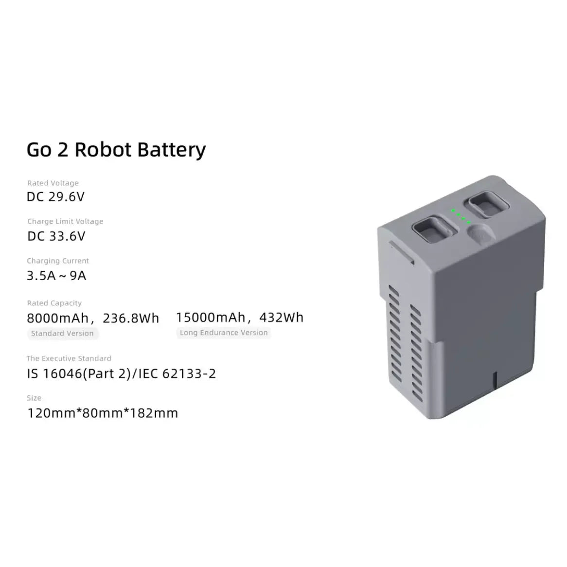
Centimeter-Level Precision Mapping
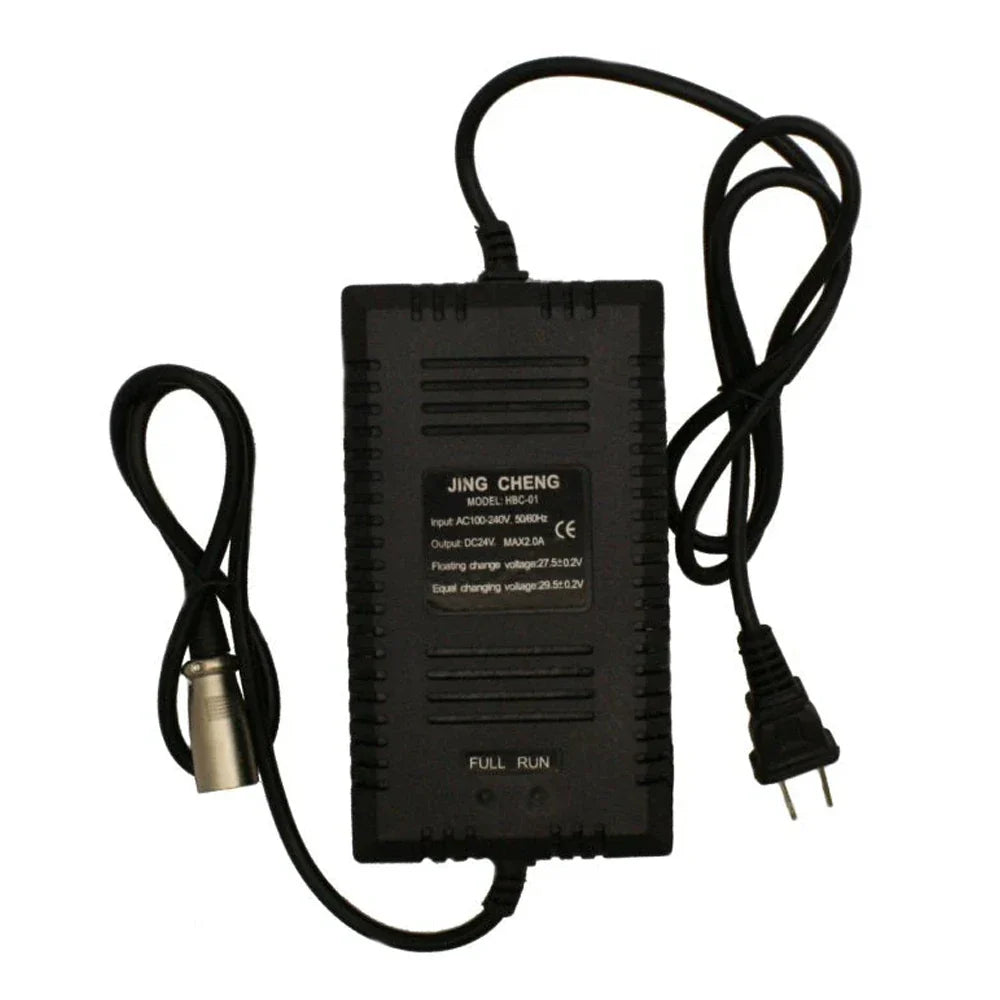
The integrated RTK module enables industries like agriculture and construction to achieve centimeter-level positioning and aerial mapping of large areas with exceptional accuracy. It delivers a horizontal accuracy of 1 cm + 1 ppm and vertical accuracy of 1.5 cm + 1 ppm, with data acquisition taking approximately 3 minutes.
For complex environments prone to interference, the EVO II Pro can be paired with optional NTRIP RTK base stations and networks, enhancing mapping accuracy and data stability. When connected to an NTRIP network, no ground control points (GCPs) are required, as the drone links directly to the network. It records original satellite observation data, camera exposure parameters, and more, while supporting PPK post-processing to further refine data accuracy.
Autel Explorer for Precision Mapping
The Autel Explorer app enhances the EVO II Pro V3 drone’s mapping capabilities with a suite of powerful features for efficient and accurate mission execution.
-
Multi-NTRIP Profile Saving – Enables the drone to seamlessly resume a mission after a battery change without losing progress.
-
Photo Replication – Records all gimbal, camera, and drone movements, allowing missions to be accurately repeated.
-
Multi-Battery Missions – Saves multiple NTRIP profiles for different locations, eliminating the need to manually re-enter account details for each flight.
-
Flexible Mapping Options – Supports rectangular and polygonal mapping missions, along with double-grid mapping for additional angles.
-
Advanced Camera Control – Gain full manual control over camera settings for optimal image capture.
-
Efficient Flight Pathing – Nonstop corner turning minimizes downtime, conserving battery life.
-
Customizable Course Headings – Adjust orientation settings to align with specific project requirements.
With Autel Explorer, mapping missions are streamlined, precise, and highly adaptable to various industry needs.
Smart Controller V3 with SkyLink 2.0
The Smart Controller V3 leverages SkyLink 2.0 technology to deliver stable, long-range HD video transmission. Its 7.9″ ultra-bright display provides clear visuals even in direct sunlight, with 2000 cd/m² brightness.
-
Extended Transmission Range – Receive HD video up to 9.32 miles away or QHD quality up to 0.62 miles.
-
Triple-Band Frequency Hopping – 900 MHz, 2.4 GHz, and 5.8 GHz for interference-free connectivity.
-
All-Weather Durability – IP43-rated and designed to withstand temperatures from -4 to 104°F.
360-Degree Obstacle Avoidance
Equipped with 19 sensors, including 12 visual sensors, the main camera, ultrasound IMUs, and more, the drone actively builds a real-time 3D map of its surroundings, ensuring precise path planning and collision avoidance.
Additional Features
-
Level 8 Wind Resistance – Ensures stable flight in strong winds.
-
Advanced Zoom Capabilities – Up to 16x digital zoom and 3x lossless zoom.
-
Extended Flight Time – Up to 38 minutes of continuous operation.
-
High ISO Performance – Maximum ISO of 44,000 for superior low-light imaging.
-
Live Deck 2 Compatibility – Enables real-time mission broadcasting.
-
Unrestricted Takeoff – No built-in fly zones, allowing unrestricted flights when needed.
-
Firmware Flexibility – Can be flown even if firmware and app updates are incomplete.
The Smart Controller V3 ensures seamless operation, real-time situational awareness, and superior image quality, making it a powerful tool for professional drone pilots.